{
"uuid": "7cab2353-bb1f-4d04-84c1-a19de9d9fd92",
"type": "records",
"etag": "da55e2ae3d7f06edbb98e360c739abbced829ef3",
"data": {
"dwc:startDayOfYear": "141",
"dwc:county": "Idaho County",
"dwc:recordedBy": "M. L. Thornton",
"dwc:georeferenceSources": "georef batch tool 2015-02-10; GeoLocate",
"dcterms:references": "https://mycoportal.org/portal/collections/individual/index.php?occid=1959863",
"dwc:occurrenceID": "6e3e9d2f-cc7b-436b-a704-a6281e2ca452",
"id": "1959863",
"dwc:stateProvince": "Idaho",
"dwc:eventDate": "1971-05-21",
"dwc:collectionID": "9d863f79-0cb6-4493-9872-8f72d6c79e69",
"dwc:institutionCode": "MONTU",
"dwc:country": "USA",
"idigbio:recordId": "urn:uuid:6e3e9d2f-cc7b-436b-a704-a6281e2ca452",
"dwc:georeferenceRemarks": "Georeferenced to Cedar Grove Picnic Area between Measure Road and Lochsa River with uncertainty extending out to Lochsa Lodge to the southwest.",
"symbiota:recordEnteredBy": "Michael Yost",
"dwc:decimalLatitude": "46.53931",
"dwc:georeferenceVerificationStatus": "reviewed - high confidence",
"dwc:basisOfRecord": "PreservedSpecimen",
"dc:rights": "http://creativecommons.org/publicdomain/zero/1.0/",
"dwc:identifiedBy": "W. C. Figiel",
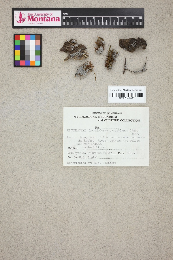
"dwc:habitat": "On leaf litter.",
"dwc:locality": "East of the DeVoto Cedar Grove on the Lochsa River, between the bridge and the cedars.",
"dwc:geodeticDatum": "WGS84",
"dwc:catalogNumber": "MONTU-F-001137",
"dwc:month": "5",
"dwc:decimalLongitude": "-114.674847",
"dwc:georeferencedBy": "Michael Yost (2015-02-10 22:47:45)",
"dwc:recordNumber": "1089",
"dwc:georeferenceProtocol": "GBIF Best Practices",
"dcterms:modified": "2015-08-11 11:37:50",
"dwc:coordinateUncertaintyInMeters": "4701",
"dwc:day": "21",
"dwc:year": "1971"
},
"indexTerms": {
"recordset": "7340c0df-8829-4197-9dc7-0328b8e7f5dd",
"dqs": 0.2463768115942029,
"stateprovince": "idaho",
"county": "idaho county",
"catalognumber": "montu-f-001137",
"startdayofyear": 141,
"collector": "m. l. thornton",
"continent": "north america",
"uuid": "7cab2353-bb1f-4d04-84c1-a19de9d9fd92",
"countrycode": "usa",
"basisofrecord": "preservedspecimen",
"institutioncode": "montu",
"mediarecords": [
"7a3f4baa-d844-47cc-bdc4-a23f9b166e59"
],
"datecollected": "1971-05-21T00:00:00+00:00",
"etag": "da55e2ae3d7f06edbb98e360c739abbced829ef3",
"recordnumber": "1089",
"hasImage": true,
"collectionid": "9d863f79-0cb6-4493-9872-8f72d6c79e69",
"locality": "east of the devoto cedar grove on the lochsa river, between the bridge and the cedars.",
"hasMedia": true,
"coordinateuncertainty": 4701,
"datemodified": "2021-04-19T22:44:35.141833+00:00",
"occurrenceid": "6e3e9d2f-cc7b-436b-a704-a6281e2ca452",
"country": "united states",
"geopoint": {
"lat": 46.53931,
"lon": -114.674847
},
"flags": [
"dwc_country_replaced",
"idigbio_isocountrycode_added",
"dwc_continent_added"
],
"recordids": [
"urn:uuid:6e3e9d2f-cc7b-436b-a704-a6281e2ca452",
"7340c0df-8829-4197-9dc7-0328b8e7f5dd\\6e3e9d2f-cc7b-436b-a704-a6281e2ca452",
"7340c0df-8829-4197-9dc7-0328b8e7f5dd\\1959863"
],
"eventdate": "1971-05-21",
"indexData": {
"dwc:startDayOfYear": "141",
"flag_dwc_country_replaced": true,
"dwc:geodeticDatum": "WGS84",
"dwc:county": "Idaho County",
"dwc:recordedBy": "M. L. Thornton",
"idigbio:uuid": "7cab2353-bb1f-4d04-84c1-a19de9d9fd92",
"dwc:georeferenceSources": "georef batch tool 2015-02-10; GeoLocate",
"dwc:habitat": "On leaf litter.",
"idigbio:recordIds": [
"urn:uuid:6e3e9d2f-cc7b-436b-a704-a6281e2ca452",
"7340c0df-8829-4197-9dc7-0328b8e7f5dd\\6e3e9d2f-cc7b-436b-a704-a6281e2ca452",
"7340c0df-8829-4197-9dc7-0328b8e7f5dd\\1959863"
],
"dwc:occurrenceID": "6e3e9d2f-cc7b-436b-a704-a6281e2ca452",
"symbiota:recordEnteredBy": "Michael Yost",
"idigbio:parent": "7340c0df-8829-4197-9dc7-0328b8e7f5dd",
"dwc:stateProvince": "Idaho",
"dwc:eventDate": "1971-05-21",
"dwc:collectionID": "9d863f79-0cb6-4493-9872-8f72d6c79e69",
"dwc:country": "united states",
"idigbio:recordId": "urn:uuid:6e3e9d2f-cc7b-436b-a704-a6281e2ca452",
"idigbio:etag": "da55e2ae3d7f06edbb98e360c739abbced829ef3",
"dwc:georeferenceRemarks": "Georeferenced to Cedar Grove Picnic Area between Measure Road and Lochsa River with uncertainty extending out to Lochsa Lodge to the southwest.",
"id": "1959863",
"dwc:decimalLatitude": "46.53931",
"dwc:georeferenceVerificationStatus": "reviewed - high confidence",
"dwc:basisOfRecord": "PreservedSpecimen",
"dwc:continent": "north america",
"dc:rights": "http://creativecommons.org/publicdomain/zero/1.0/",
"dwc:identifiedBy": "W. C. Figiel",
"idigbio:siblings": {
"mediarecord": [
"7a3f4baa-d844-47cc-bdc4-a23f9b166e59"
]
},
"flag_idigbio_isocountrycode_added": true,
"dcterms:references": "https://mycoportal.org/portal/collections/individual/index.php?occid=1959863",
"idigbio:dateModified": "2021-04-19T22:44:35.141833",
"dwc:locality": "East of the DeVoto Cedar Grove on the Lochsa River, between the bridge and the cedars.",
"dwc:institutionCode": "MONTU",
"dwc:catalogNumber": "MONTU-F-001137",
"dwc:month": "5",
"dwc:decimalLongitude": "-114.674847",
"dwc:georeferencedBy": "Michael Yost (2015-02-10 22:47:45)",
"flag_dwc_continent_added": true,
"dwc:recordNumber": "1089",
"idigbio:isocountrycode": "usa",
"dwc:georeferenceProtocol": "GBIF Best Practices",
"dcterms:modified": "2015-08-11 11:37:50",
"dwc:coordinateUncertaintyInMeters": "4701",
"dwc:day": "21",
"dwc:year": "1971"
}
},
"attribution": {
"uuid": "7340c0df-8829-4197-9dc7-0328b8e7f5dd",
"name": "University of Montana Herbarium",
"description": "The Herbarium at The University of Montana (MONTU, http://herbarium.dbs.umt.edu) contains over 150,000 plant specimens and has the largest and best representation of the flora of the Northern Rocky Mountains in the world. The Herbarium is particularly well-known for its collections from the alpine and montane regions of Montana. Our vascular plant collections can be accessed via http://pnwherbaria.org. MONTU is also home to the Montana Diatom collection (http://herbarium.dbs.umt.edu/diatoms.asp), and we are excited to have our fungi collection included in the Mycoportal Database.",
"logo": "https://www.mycoportal.org/portal/self/images/collicons/montu.jpg",
"url": "http://herbarium.dbs.umt.edu/",
"emllink": "https://www.mycoportal.org/portal/collections/datasets/emlhandler.php?collid=28",
"archivelink": "https://www.mycoportal.org/portal/content/dwca/montu_dwc-a.zip",
"contacts": [
{
"email": "help@mycoportal.org"
},
{
"email": "help@mycoportal.org"
},
{
"email": "Marilyn.marler@umontana.edu"
},
{
"last_name": "Marilyn Marler",
"email": "Marilyn.marler@umontana.edu"
},
{
"last_name": "Marilyn Marler",
"email": "Marilyn.marler@umontana.edu"
}
],
"data_rights": "CC0",
"publisher": "e9c875f0-d9c9-426b-bdc8-0999eb1b6deb",
"totalCount": 1415
}
}
 The Herbarium at The University of Montana (MONTU, http://herbarium.dbs.umt.edu) contains over 150,000 plant specimens and has the largest and best representation of the flora of the Northern Rocky Mountains in the world. The Herbarium is particularly well-known for its collections from the alpine and montane regions of Montana. Our vascular plant collections can be accessed via http://pnwherbaria.org. MONTU is also home to the Montana Diatom collection (http://herbarium.dbs.umt.edu/diatoms.asp), and we are excited to have our fungi collection included in the Mycoportal Database.