{
"uuid": "b32cd1c8-404a-4268-86be-9c4978d0331e",
"type": "records",
"etag": "0e343ec519989e6e56d8a95bd63ca7688a05fcd9",
"data": {
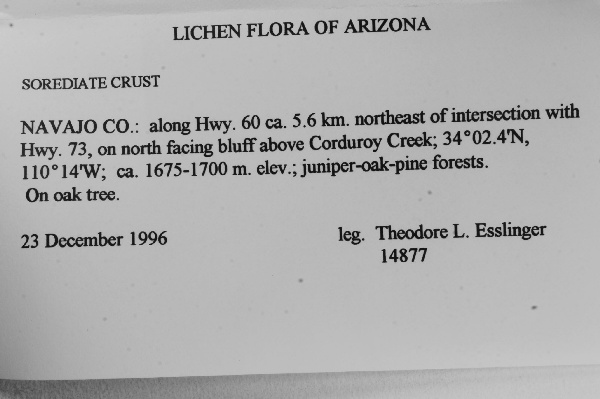
"dwc:verbatimCoordinates": "34° 2.4' N 110° 14' W",
"dwc:county": "Navajo",
"dwc:recordedBy": "T.L. Esslinger",
"dcterms:references": "http://lichenportal.org/portal/collections/individual/index.php?occid=1567178",
"dwc:occurrenceID": "1567178",
"dwc:verbatimElevation": "1675-1700 m.",
"symbiota:recordEnteredBy": "zaalexander",
"dwc:stateProvince": "Arizona",
"dwc:eventDate": "1996-12-23",
"dwc:collectionID": "8f07e9fb-8d26-49c1-8ce4-de648c7e7c0a",
"dwc:country": "United States",
"idigbio:recordId": "urn:uuid:05441798-5463-4ee3-a866-052396cee497",
"dwc:decimalLatitude": "34.04",
"dwc:occurrenceRemarks": "SOREDIATE CRUST",
"dwc:maximumElevationInMeters": "1700",
"dwc:basisOfRecord": "PreservedSpecimen",
"dwc:genus": "Undetermined",
"dc:rights": "http://creativecommons.org/licenses/by-nc/3.0/",
"dwc:habitat": "juniper-oak-pine forests.; On oak tree.",
"dwc:locality": "along Hwy. 60 ca. 5.6 km. northeast of intersection with Hwy. 73, on north facing bluff above Corduroy Creek",
"dwc:institutionCode": "TLE",
"dwc:catalogNumber": "0024407",
"dwc:decimalLongitude": "-110.233333",
"dwc:recordNumber": "14877",
"dwc:minimumElevationInMeters": "1675",
"dcterms:modified": "2015-08-11 12:57:11",
"dwc:scientificName": "Undetermined"
},
"indexTerms": {
"recordset": "dfd53a42-8f63-4040-93a5-3f1347ce7686",
"dqs": 0.2608695652173913,
"stateprovince": "arizona",
"county": "navajo",
"catalognumber": "0024407",
"startdayofyear": 358,
"collector": "t.l. esslinger",
"continent": "north america",
"uuid": "b32cd1c8-404a-4268-86be-9c4978d0331e",
"countrycode": "usa",
"basisofrecord": "preservedspecimen",
"institutioncode": "tle",
"mediarecords": [
"1916d589-d06f-4701-a86a-531f8f6c3a92"
],
"datecollected": "1996-12-23T00:00:00+00:00",
"etag": "0e343ec519989e6e56d8a95bd63ca7688a05fcd9",
"recordnumber": "14877",
"minelevation": 1675,
"hasImage": true,
"maxelevation": 1700,
"collectionid": "8f07e9fb-8d26-49c1-8ce4-de648c7e7c0a",
"scientificname": "undetermined",
"locality": "along hwy. 60 ca. 5.6 km. northeast of intersection with hwy. 73, on north facing bluff above corduroy creek",
"hasMedia": true,
"datemodified": "2015-09-30T14:33:12.072129+00:00",
"occurrenceid": "1567178",
"country": "united states",
"geopoint": {
"lat": 34.04,
"lon": -110.233333
},
"flags": [
"geopoint_datum_missing",
"geopoint_low_precision",
"idigbio_isocountrycode_added",
"dwc_continent_added",
"taxon_match_failed"
],
"recordids": [
"urn:uuid:05441798-5463-4ee3-a866-052396cee497",
"dfd53a42-8f63-4040-93a5-3f1347ce7686\\1567178"
],
"genus": "undetermined",
"eventdate": "1996-12-23",
"indexData": {
"dwc:verbatimCoordinates": "34° 2.4' N 110° 14' W",
"dwc:county": "Navajo",
"dwc:recordedBy": "T.L. Esslinger",
"idigbio:uuid": "b32cd1c8-404a-4268-86be-9c4978d0331e",
"dcterms:references": "http://lichenportal.org/portal/collections/individual/index.php?occid=1567178",
"idigbio:recordIds": [
"urn:uuid:05441798-5463-4ee3-a866-052396cee497",
"dfd53a42-8f63-4040-93a5-3f1347ce7686\\1567178"
],
"dwc:occurrenceID": "1567178",
"dwc:verbatimElevation": "1675-1700 m.",
"symbiota:recordEnteredBy": "zaalexander",
"idigbio:parent": "dfd53a42-8f63-4040-93a5-3f1347ce7686",
"dwc:stateProvince": "Arizona",
"dwc:eventDate": "1996-12-23",
"dwc:collectionID": "8f07e9fb-8d26-49c1-8ce4-de648c7e7c0a",
"dwc:country": "United States",
"idigbio:recordId": "urn:uuid:05441798-5463-4ee3-a866-052396cee497",
"idigbio:etag": "0e343ec519989e6e56d8a95bd63ca7688a05fcd9",
"dwc:decimalLatitude": "34.04",
"dwc:occurrenceRemarks": "SOREDIATE CRUST",
"dwc:maximumElevationInMeters": "1700",
"dwc:basisOfRecord": "PreservedSpecimen",
"dwc:genus": "Undetermined",
"dwc:continent": "north america",
"dc:rights": "http://creativecommons.org/licenses/by-nc/3.0/",
"idigbio:siblings": {
"mediarecord": [
"1916d589-d06f-4701-a86a-531f8f6c3a92"
]
},
"flag_idigbio_isocountrycode_added": true,
"dwc:habitat": "juniper-oak-pine forests.; On oak tree.",
"idigbio:dateModified": "2015-09-30T14:33:12.072129",
"dwc:locality": "along Hwy. 60 ca. 5.6 km. northeast of intersection with Hwy. 73, on north facing bluff above Corduroy Creek",
"dwc:institutionCode": "TLE",
"dwc:catalogNumber": "0024407",
"dwc:decimalLongitude": "-110.233333",
"flag_dwc_continent_added": true,
"dwc:recordNumber": "14877",
"idigbio:isocountrycode": "usa",
"flag_taxon_match_failed": true,
"dwc:minimumElevationInMeters": "1675",
"dcterms:modified": "2015-08-11 12:57:11",
"dwc:scientificName": "Undetermined"
}
},
"attribution": {
"uuid": "dfd53a42-8f63-4040-93a5-3f1347ce7686",
"name": "T. L. Esslinger Herbarium",
"description": "T. L. Esslinger's private collection.",
"logo": "http://lichenportal.org/portal/images/collicons/TLE.jpg",
"url": "http://www.ndsu.edu/pubweb/~esslinge/chcklst/chcklst7.htm",
"emllink": "http://lichenportal.org/portal/collections/datasets/dwc/tle_dwc-a.eml",
"archivelink": "http://lichenportal.org/portal/collections/datasets/dwc/tle_dwc-a.zip",
"contacts": [
{
"email": "CNALHadmin@asu.edu"
},
{
"first_name": "T. L. Esslinger",
"email": "ted.esslinger@ndsu.edu"
}
],
"data_rights": "CC3 BY-NC",
"publisher": "efd00b2c-5ade-4a90-a95a-3f9188fcfa71",
"totalCount": 26072
}
}
 T. L. Esslinger's private collection.